Saturday, April 9, 2011

Do Bombs Cause Earthquakes?

There was an earthquake in Afghanistan in March 2002. Coincidentally, there was a lot of bombing going on. Or was it coincidence? Many people ask, Do aerial bombardments cause quakes? Scientists immediately say No. First of all, they don't like the word "cause."
An earthquake is the sudden release of strain energy in the Earth's crust (see "Earthquakes in a Nutshell"), but strain builds up from several different causes: the movements of plate tectonics, the weight of sediments shifting from erosion or from deposition, changes in fluids underground, and more obscure factors like mineral phase changes in the mantle (see "Deep Earthquakes"). They all add up, and we can't single out one of them as the cause. Scientists prefer to talk about what might trigger or induce an earthquake.

Do Bombs Induce Quakes?

OK, then, let's ask again. Did the bombing induce the quake? From a century of experience, we can confidently answer No. Some human activities do induce earthquakes, but not bombing like that in Afghanistan.
The question is easy to test: just look at the seismic record and see if earthquakes increase after episodes of bombing. Unfortunately, there has been plenty of bombing in the last hundred years. Fortunately, seismologists have monitored earthquakes for that whole century. No increase in quakes—not even little ones—follows bombing campaigns.
Some authorities have tried to blame quakes on bombs. After the 31 May 1970 Peruvian earthquake (still remembered for the deadly landslide it triggered from the mountain Huascarán), the Peruvian government accused the French of setting it off with their atomic tests in Mururoa Atoll, all the way across the Pacific. Peruvian scientists at the multinational research agency CERESIS responded in the press that this was nonsense.
There are other short-period natural mechanisms that you could compare with bombing: stresses from the tides, storm winds blowing against mountain ranges, landslides, volcanic eruptions and the shaking of nearby earthquakes. Those mechanisms involve a great deal more energy than bombing, and they're more coherent—less random.
None of those correlate with earthquakes either, with one uncommon exception: sometimes a large earthquake can trigger smaller ones at a distance. The 1992 Landers quake was the first clear example, and that was a large event, magnitude 7.3. The 2002 Denali earthquake in Alaska, magnitude 7.9, triggered events thousands of kilometers away at Yellowstone in Wyoming.
So the forces that ordinary bombs exert don't cause earthquakes. The amount of energy in bomb explosions is microscopic compared to the energies of earthquakes. It's like the difference between playing on a piano and dropping the piano down a flight of stairs.

Can Humans Induce Earthquakes at All?

We do have some good examples of human activities causing triggered quakes. It takes years of concerted effort, but they happen.
One type of induced quake occurs where fluids are pumped out of or into the ground. Oil-producing districts, for example, or areas where toxic wastewater is pumped into deep disposal wells experience small shocks that are sometimes strong enough to feel.
Another type happens where new water reservoirs are created. The first famous example was after the Hoover Dam created Lake Mead in southern Nevada. Hundreds of local earthquakes, some up to magnitude 5, happened in the decade after 1934.
Underground mines disrupt the natural stress state of underground rocks. The wall of a mine passage has all the weight of the rock above it pressing down, but no weight on the open side. Sometimes the wall bursts from the strain, spraying the passage with rock bits and destroying anything nearby.
Seismograph records of rock bursts look much like earthquakes. The largest known rock burst happened in a German potash mine in 1989 and had a magnitude of 5.7. It demolished the mine openings and damaged most of the town of Volkershausen.
Another kind of mining-induced quake happens as the ground subsides into the mined-out space. These are smaller, gentler events than rock bursts. But when large open spaces are mined out, the energy involved in a ceiling collapse can be substantial. The "mountain bump" that destroyed the Crandall Canyon coal mine in Utah on 6 August 2007 reached magnitude 3.9.
All of these types of human-induced seismicity happen from long-term changes in the underground stress field, not the brief, tiny stresses from bomb explosions.
OK, what about nuclear explosions? Well, they indeed cause earthquakes—that is, they are earthquakes, releases of energy that are felt as shaking and recorded by seismographs around the world. But not even the largest bomb test has ever induced a natural earthquake. (The Berkeley Seismological Laboratory explains more.)
PS: Like natural earthquakes, underground nuclear tests have aftershocks. We know this because they act like aftershocks: they are smaller than the main event, cluster around its location, and decrease as time passes. Also, the largest bomb tests have the same magnitude as moderate earthquakes, and their aftershocks are smaller by a full unit of magnitude (that is, they obey Båth's law), just like natural aftershocks.

Earthquake prediction

For a statement to be accepted as a valid earthquake prediction, it has to contain the expected magnitude with error limits, the well defined area of the epicenter, the range of dates, and the probability of this to come true. The data from which the prediction was derived must be verifiable and the analysis of these data must be reproducible. Long term predictions (years to decades) are more likely to be achieved than medium term predictions (months to years), and short term predictions (hours to days) are in general unlikely to be possible, at present. If a plausible mechanism linking the observations with the predicted earthquake is not offered, the credibility of the prediction is diminished, but it may not necessarily be rejected. Evaluations of apparent successes must include a statistical estimate of the probability that the prediction came true by chance, which is often the case with predictions by amateurs. Whether a prediction is scientific or amateurish is not based on who makes the prediction, but based on how the prediction is made and tested. Predictions can be formulated either by defining the limits of the parameters probabilistically or by firm values.

The problem of earthquake prediction

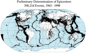
In efforts to predict earthquakes, seismologists have investigated the association of an impending earthquake with such varied phenomena as seismicity patterns,[1][2][3][4][5][6] crustal movements,[7][8] ground water level in wells,[9] radon or hydrogen gas emissions from the Earth,[10][11] changes of seismic wave velocities,[12] electromagnetic fields (seismo-electromagnetics),[13] large-scale changes in soil temperature,[14] and changes in ion concentration in the ionosphere.[14] A relatively recent review is found in [15] and a special issue of Pure and Applied Geophysics contains a collection of recent articles on the subject.[16]

The mystery of earthquake occurrence frequently sparks people without scientific training into claiming that they have found the solution to the earthquake prediction problem. Discredited, fantastic theories of predicting earthquakes include weather conditions and unusual clouds, and the phases of the moon.[17] These pseudoscientific theories and predictions[18] ignore the requirement of rigorously formulating the hypothesis and to test it statistically [1].

Self-appointed prediction experts often resort to the technique of making vague statements, which they claim were correct predictions, after an earthquake has happened somewhere.[19] Rudolf Falb's "lunisolar flood theory" is a typical example from the late 19th century.

Precursory seismicity patterns
[edit] The Mogi doughnut

In 1969 Japanese seismologist Kiyoo Mogi proposed what has become known as the 'Mogi doughnut hypothesis', which suggests that major earthquakes tend to occur in an unusually seismically calm area surrounded by a ring of unusually high seismic activity.[20][21][22]
[edit] Geochemical precursors
[edit] Radon

Emission of radon as a quake precursor was studied in the 1970s and 80s with no reliable results and continued to be dismissed by most seismologists until recently. However, after the 2009 L'Aquila earthquake, which was preceded by an Italian laboratory technician's predictions of an impending major earthquake, some in the scientific community expressed renewed interest in radon as a quake precursor. In December 2009, the technician, Giampaolo Giuliani, presented his research to the American Geophysical Union in San Francisco and was later invited by the American Geophysical Union to participate in developing a worldwide seismic early warning system.[23]
Further information: Radon#Scientific
[edit] Precursory crustal deformation

Under construction
[edit] Electromagnetic precursors
[edit] VAN claims
Main article: VAN method

VAN is a controversial method of earthquake prediction proposed by Professors Varotsos, Alexopoulos and Nomicos in the 1980s; it was named after the researchers' initials. The method is based on the detection of "seismic electric signals" (SES) via a telemetric network of conductive metal rods inserted in the ground; it stems from theoretical predictions by P. Varotsos, a solid-state physicist at the National and Capodistrian University of Athens.[24] Researchers have claimed to be able to predict earthquakes of magnitude larger than 5, within 100 km of epicentral location, within 0.7 units of magnitude and in a 2-hour to 11-day time window, but this is disputed.
[edit] Combined measurements of different precursors

Under construction
[edit] Foreshocks

Foreshocks are medium-sized earthquakes that precede major quakes.

An increase in foreshock activity[25] (combined with purported indications like ground water levels and strange animal behavior) enabled the successful evacuation of a million people one day before the February 4, 1975 M7.3 Haicheng earthquake[26] by the China State Seismological Bureau.

While 50% of major earthquakes are preceded by foreshocks, only about 5-10% of small earthquakes turn out to be foreshocks, leading to false warnings.[25][27][28]
[edit] Earthquake forecasts and partial predictions
[edit] Early warning

An earthquake warning system is a system of accelerometers, communication, computers, and alarms that is devised for regional notification of a substantial earthquake while it is in progress. Japan, Taiwan and Mexico all have earthquake early-warning systems.

In a paper in the journal Nature, Richard Allen of the University of California claims that the distinction between small and large earthquakes can be made from the very first seconds of seismic energy recorded by seismometers, though other scientists are not convinced.[29] If correct this may make earthquake early warning (as distinct from prediction) more powerful. Earthquake early warning provides an alarm that strong shaking is due soon to arrive, and the more quickly that the magnitude of an earthquake can be estimated, the more useful is the early warning. However, earthquake early warning can still be effective without the ability to infer the magnitude of an earthquake in its initial second or two.
[edit] Triggering earthquakes
[edit] Solid Earth tides

There are two flavors of tidal stressing that have been claimed to generate enhanced rates of earthquakes—diurnal and biweekly tides. The diurnal correlations would arise from more earthquakes only during the hours when the tidal stress is pushing in an encouraging direction, in contrast, biweekly effects would be based on earthquakes occurring during the days when the sinusoidal stressing oscillations are largest. The former, as most easily observed in the twice-daily rise and fall of the ocean tides, have occasionally been shown to influence earthquakes (e.g.,[30] this paper shows there may be some weak tidal triggering of shallow, oceanic thrust-faulting earthquakes). The latter, which arises from the periodic alignment of the Sun and Moon, has often been claimed in the popular press to incubate earthquakes (sometimes termed the "syzygy" effect) and occasionally for small datasets in the scientific literature (e.g.,[31]), but generally such effects do not appear in careful studies of large datasets.


A paper published in Taiwan, by the Department of Astronomy, Beijing Normal University, found a significant relationship to tidal forces and earthquakes in China and Taiwan. The paper considers the relationship between 21 major earthquakes (Ms ≥ 7.0) in land and the offshore area of Taiwan island in the 20th century and the variance ratio of the lunar-solar tidal force. The result indicates that the time of these earthquakes is closely related to the variance ratio of the lunar-solar tidal force, and therefore that the tidal force possibly plays an important role in triggering earthquakes.[32] The conclusion is this method may be used to help forecast earthquakes by studying the lunar perigee.

Syzygy, which is not given much credence in the scientific community, is motivated by the observation that, historically, there have been some great earthquakes whose timing coincides with tidal forces near their maximum. For maximum tidal force, three factors must coincide: first, when the moon (in its elliptical orbit) is closest to the earth; second, when it is within a day or two of a new moon (so that the tidal forces of the moon and sun are acting in concert); and third, when the earth (in its elliptical orbit) is at or near its closest distance to the sun.

Shallow earthquakes near mid-ocean ridges, volcanic earthquakes, and episodic tremor and slip have also been observed to sometimes correlate with the diurnal tides, with enhanced activity correlating with times that faults are unclamped.
[edit] Evaluation of prediction claims and methods
[edit] National prediction evaluation councils

Official earthquake prediction evaluation councils have been established in California (the California Earthquake Prediction Evaluation Council) and the federal government in the United States (the National Earthquake Prediction Evaluation Council), but have yet to endorse any method of predicting quakes as reliable.[25]

Unless the following parameters are specified, a statement does not qualify as an earthquake prediction:[33]

    A specific location or area
    A specific span of time
    A specific magnitude range
    A specific probability of occurrence

[edit] International evaluation of claims and methods

The sub-commission for earthquake prediction of IASPEI (International Association of Seismology and Physics of the Earth’s Interior) has reviewed claims of successful predictions and of proposed methods to predict during the 1990s. Their procedure was similar to reviews of proposals for research grants. Authors submitted their detailed research on the prediction problem. Anonymous reviewers commented, and members of the sub-commission discussed the merits of the proposal and of the reviewer’s comments.

A decision to place the claim into one of three categories (preliminary list of significant precursors, no decision, rejected) was then transmitted to the authors, who could write a reply, if they so wished. The entire exchange was then published, unless the authors did not agree to publication.[34][35] Most of the nominated successful predictions and methods to predict were rejected.[36] At that time, three methods seemed most promising: Seismicity patterns, ground water properties, and crustal deformations.[37]

Attribution to a plausible physical mechanism lends credibility, and suggests a means for future improvement. Reproducibility and statistical analysis are used to distinguish predictions which come true due to random chance (of which a certain number are expected) versus those that have more useful predictive capability, and to validate models of long-term probability. Such models are difficult to test or validate because large earthquakes are so rare, and because earthquake activity is naturally clustered in space and time. "Predictions" which are made only after the fact are common but generally discounted.
[edit] The problem of anecdotal claims
[edit] Animal behavior

Animal behavior reports are often ambiguous and not consistently observed. In folklore, some animals have been identified as being more able to predict earthquakes than others, especially dogs, cats, chickens, horses, toads and other smaller animals.

It has been postulated that the reported animal behavior before an earthquake is simply their response to an increase in low-frequency electromagnetic signals.[38] The University of Colorado has demonstrated that electromagnetic activity can be generated by the fracturing of crystalline rock. Such activity occurs in fault lines before earthquakes. According to one study, electromagnetic sensors yield statistically valid results in predicting earthquakes.[39]

In Italy, findings from 2009 suggest that toads are able to detect pre-seismic cues.[40]
[edit] Fractoluminescence

One possible method for predicting earthquakes, although it has not yet been applied, is fractoluminescence. Studies at the Chugoku National Industrial Research Institute by Yoshizo Kawaguchi have shown that upon fracturing, silica releases red and blue light for a period of about 100 milliseconds. Kawaguchi attributed this to the relaxation of the free bonds and unstable oxygen atoms that are left when the silicon oxygen bonds have broken due to the stresses within the rock.[41]
[edit] Satellite observations
[edit] Demeter microsatellite

The "Detection of Electro-Magnetic Emissions Transmitted from Earthquake Regions" satellite, constructed by CNES, has made observations which show strong correlations between certain types of low frequency electromagnetic activity and the most seismically active zones on the Earth, and have shown a sharp signal in the ionospheric electron density and temperature near southern Japan seven days before a 7.1 magnitude occurred there (on August 29 and September 5, 2004, respectively).[42]
[edit] QuakeSat nanosatellite

Quakesat is an earth observation nanosatellite based on 3 CubeSats. It was designed to be a proof-of-concept for collecting extremely low frequency earthquake precursor signals from space. The primary instrument is a magnetometer housed in a 2 foot (0.6 m) telescoping boom.
[edit] The ESPERIA Project

ESPERIA is an equatorial space mission mainly concerned with detecting any tectonic and preseismic related signals. More in general, it has been proposed for defining the near-Earth electromagnetic, plasma, and particle environment, and for studying perturbations and instabilities in the ionosphere-magnetosphere transition region. To study earthquake preparation processes and anthropogenic impacts in the Earth's surface, a phase A study has been realized for the Italian Space Agency.[43]
[edit] DESDynI radar satellite

The Deformation, Ecosystem Structure and Dynamics of Ice (DESDynI) radar satellite, which was canceled in the White House's 2012 budget proposal, would have the capacity to identify elastic strain in tectonic plates, combining L-band interferometric synthetic aperture radar and a multi-beam infrared lidar to detect strains in the Earth’s surface that could lead to serious earthquakes. [44][45]
[edit] TwinSat

Russia and the United Kingdom have agreed to jointly deploy two satellites in 2015 that will measure electromagnetic signals that are released from the earth's crust prior to earthquakes. The project is said to be able to "help predict earthquakes and potentially save thousands of lives." [46]
[edit] History of prediction attempts
[edit] China

After a series of foreshocks, the Chinese government was able to successfully evacuate much of the populace before the 1975 Haicheng earthquake. However, the Chinese government failed to predict the July 28, 1976 M7.8 Tangshan earthquake, which put Chinese earthquake prediction research in doubt for several years. In the late 1990s, there were over thirty false alarms unofficially announced in China,[47] but the Chinese government claimed successful prediction of the November 29, 1999, M5.4 Gushan-Pianling Earthquake in Haicheng city and Xiuyan city, Liaoning Province.[48]
[edit] Japan

The Japanese government established the Imperial Earthquake Investigation Committee in 1892 in response to the Nobi (Mino-Owari) earthquake (1891) which caused significant damage in Japan.[49]

In the 1970s and 1980s, the Japanese government embarked on a major earthquake preparedness campaign, which some criticized as emphasizing prediction too much over mitigation.[50] It failed to result in a prediction of the Great Hanshin earthquake which devastated the city of Kobe in 1995. See also 2011 Tōhoku earthquake and tsunami.
[edit] Failed Lima prediction

An earthquake predicted by a scientist at the U.S. Bureau of Mines to occur on June 28, 1981, in Lima, Peru, failed to materialize. Despite being dismissed by the U.S. National Earthquake Prediction Evaluation Council, the prediction caused popular fear and many left the city.[51]
[edit] Failed Parkfield earthquake prediction
Main article: Parkfield earthquake

Based on a history of regularly spaced earthquakes in the early 20th century, the USGS in 1985 began an experiment based on the predictions and published papers of Allan Lindh and W.H. Bakun of the USGS and T.V. McEvilly of the University of California at Berkeley. The goal was to predict a 6.0 magnitude earthquake near Parkfield, California.[52]

    "Bakun and Lindh summarized the state of the art in the Parkfield Prediction Experiment, and predicted that a moderate-size earthquake would occur at Parkfield between 1985 and 1993. Their prediction was unusual both in its precision (as to location, time and magnitude) and high degree of confidence (95% within the 9-year window). Bakun and Lindh (1985) also suggested that the predicted earthquake could produce extended rupture of the San Andreas fault to the southeast, possibly growing to magnitude 6.5 to 7.0."[53]

Media attention focused on the prediction and the experiment. 122,000 pamphlets were mailed to residents of the Parkfield area, entitled "The Parkfield Earthquake Prediction."[54] Despite the prediction, such an earthquake did not occur until after the end of the prediction window, in 2004.[25]
[edit] Loma Prieta prediction

From 1968 to 1988 scientists in California mapped seismic activity on a cross section of the fault lines. They identified a "seismic gap" in the Loma Prieta area from various features of the regional seismicity. They therefore concluded that Loma Prieta was due for an earthquake.[citation needed] Smaller quakes several months beforehand were treated as possible foreshocks, but the warnings had expired by the date of the moment magnitude 6.9 quake, on 17 October 1989.[25]
Further information: 1989 Loma Prieta earthquake
[edit] Failed New Madrid prediction by Iben Browning

In 1989 Iben Browning predicted a major earthquake in the New Madrid fault zone of southern Missouri and specified December 2 or 3, 1990, as the most likely days. This prediction was reported on extensively in the media and lead to great community concern. No earthquake occurred on those days or thereafter.
[edit] Jim Berkland

Jim Berkland claims to have predicted the Loma Prieta quake,[55] but the mainstream scientific community does not endorse his techniques as repeatable, attributing his success with this quake partly to random chance.
[edit] Failed SoCal prediction

In early 2004, a group of scientists at the University of California, Los Angeles, led by Dr. Vladimir Keilis-Borok, predicted that a quake similar in strength to the San Simeon earthquake of 2003 would occur in a 12,000 square mile (31,100 km) area of Southern California by September of that year. The odds were given as 50/50.

In April 2004, the California Earthquake Prediction Evaluation Council (CEPEC) evaluated Keilis-Borok's prediction and reported to the California State Office of Emergency Services.[56] CEPEC concluded that the "uncertainty along with the large geographic area included in the prediction (about 12,400 square miles) leads (us) to conclude that the results do not at this time warrant any special policy actions in California.” The predicted time window came and went with no significant earthquake.
[edit] L'Aquila controversy

Italian technician Giampaolo Giuliani claims to have predicted the 2009 L'Aquila earthquake. He was reported to Italian police for "causing fear" but he was acquitted.[57] His prediction was dismissed by other scientists and politicians as a fluke.[58]
[edit] 2010 Chile earthquake

A group of scientists met with Chilean officials in Talcahuano several months prior to the 2010 Chile earthquake, warning them of the possibility of a large earthquake and tsunami. Daniel Melnick, a geologist from Potsdam University, called this an example of a correct prediction. Government authorities, however, did not take action

Deadliest earthquakes on record

Deadliest Earthquakes on Record

(50,000 deaths or more)

The following table lists the deadliest earthquakes on record according to date, location, number of deaths, and magnitude. On Jan. 23, 1556, an 8.0 magnitude earthquake struck Shansi, China killing 830,000 people.
DateLocationDeathsMagnitude
Jan. 23, 1556Shansi, China 830,000~8
July 27, 1976Tangshan, China 255,00017.5
Aug. 9, 1138Aleppo, Syria230,000n.a.
Dec. 26, 2004off west coast of northern Sumatra225,000+9.0
Jan. 12, 2010Haiti222,5707.0
Dec. 22, 8562Damghan, Iran200,000n.a.
May 22, 1927near Xining, Tsinghai, China 200,0007.9
Dec. 16, 1920Gansu, China200,0007.8
March 23, 8932Ardabil, Iran150,000n.a.
Sept. 1, 1923Kwanto, Japan143,0007.9
Oct. 5, 1948Ashgabat, Turkmenistan, USSR110,0007.3
Dec. 28, 1908Messina, Italy70,000–
100,0003
7.2
Sept. 1290Chihli, China100,000n.a.
May 12, 2008Eastern Sichuan, China87,5877.9
Oct. 8, 2005Pakistan 80,3617.6
Nov. 1667Shemakha, Caucasia 80,000n.a.
Nov. 18, 1727Tabriz, Iran 77,000n.a.
Dec. 25, 1932Gansu, China 70,0007.6
Nov. 1, 1755Lisbon, Portugal 70,0008.7
May 31, 1970Peru 66,0007.9
May 30, 1935Quetta, Pakistan 30,000–
 60,000
7.5
Jan. 11, 1693Sicily, Italy 60,000n.a.
12684Silicia, Asia Minor 60,000n.a.
June 20, 1990Iran 50,0007.7
Feb. 4, 1783Calabria, Italy  50,000n.a.
1. Official. Estimated death toll as high as 655,000.
2. Note that these dates are prior to A.D. 1000. No digit is missing.
3. Estimated.
4. No date available.
Source: National Earthquake Information Center, U.S. Geological Survey. Data compiled from several sources.

Largest earthquakes by magnitude

Listed the earthquake with moment magnitude scale or Richter magnitude scale 8.5 and above. This list may be biased towards recent years due to the development and widespread deployment of seismometers. Records detailed enough to make magnitude estimates were not generally available before 1900.

May 22, 1960     Valdivia, Chile     1960 Valdivia earthquake     9.5

March 27, 1964     Prince William Sound, Alaska, USA     1964 Alaska earthquake     9.2

December 26, 2004     Indian Ocean, Sumatra, Indonesia     2004 Indian Ocean earthquake     9.1–9.3

November 4, 1952     Kamchatka, Russia (then USSR)     1952 Kamchatka earthquakes     9.0

March 11, 2011     Pacific Ocean, Tōhoku region, Japan     2011 Tōhoku earthquake     9.0

November 25, 1833     Sumatra, Indonesia     1833 Sumatra earthquake     8.8–9.2

January 31, 1906     Ecuador – Colombia     1906 Ecuador-Colombia earthquake     8.8

February 27, 2010     Maule, Chile     2010 Chile earthquake     8.8
January 26, 1700     Pacific Ocean, USA and Canada     1700 Cascadia earthquake     8.7–9.2 (est.)

July 8, 1730     Valparaiso, Chile     1730 Valparaiso earthquake     8.7–9.0 (est.)

November 1, 1755     Atlantic Ocean, Lisbon, Portugal     1755 Lisbon earthquake     8.7

February 4, 1965     Rat Islands, Alaska, USA     1965 Rat Islands earthquake     8.7

July 9, 0869     Pacific Ocean, Tōhoku region, Japan     869 Sanriku earthquake     8.6 (est.)

August 15, 1950     Assam, India – Tibet, China     1950 Medog earthquake     8.6

March 9, 1957     Andreanof Islands, Alaska, USA     1957 Andreanof Islands earthquake     8.6

March 28, 2005     Sumatra, Indonesia     2005 Sumatra earthquake     8.6

August 13, 1868     Arica, Chile (then Peru)     1868 Arica earthquake     8.5–9.0 (est.)

December 16, 1575     Valdivia, Chile (Kingdom of Chile)     1575 Valdivia earthquake     8.5

October 20, 1687     Lima, Peru (Viceroyalty of Peru)     1687 Peru earthquake     8.5 (est.)

May 24, 1751     Concepción, Chile (Kingdom of Chile)     1751 Concepción earthquake     8.5 (est.)

November 11, 1922     Atacama Region, Chile     1922 Vallenar earthquake     8.5

February 3, 1923     Kamchatka, Russia (USSR)     1923 Kamchatka earthquakes     8.5

February 1, 1938     Banda Sea, Indonesia (Dutch East Indies)     1938 Banda Sea earthquake     8.5

October 13, 1963     Kuril Islands, Russia (USSR)     1963 Kuril Islands earthquake     8.5

September 12, 2007     Sumatra, Indonesia     2007 Sumatra earthquakes     8.5

Biggest Earthquake Ever Recorded

Thanks to the extensive records of the United States Geological Service (USGS), it is quite easy to learn about the biggest earthquake ever recorded, which occurred near the cities of Valdivia and Puerto Montt, Chile, in 1960. Known as the Great Chilean Earthquake, the quake measured an impressive 9.5 on the Richter scale. The death toll of the Great Chilean Earthquake is not known, although the USGS estimates about 1,655 people died, and the earthquake may have caused as much as $800 billion US Dollars (USD) in damage.

It is highly probable that some ancient earthquakes were of a higher magnitude, but because the Richter scale was not developed until the 1930s, it is difficult to quantitatively compare them. For example, the Lisbon Earthquake of 1755 was by all accounts quite severe, and it generated a massive tsunami which only magnified the death toll, and the Shaanxi Earthquake which occurred in China in the 1500s was the deadliest known to history, killing almost one million people. The Shaanxi Earthquake may also have been the biggest earthquake known to man, but there is simply no way to tell.

In terms of earthquakes which were studied, measured, and recorded on the Richter Scale, however, the Great Chilean Earthquake was far and away the biggest earthquake ever. Keeping in mind that the Richter Scale runs along an exponential progression, the next largest earthquake was a 1964 tremblor in Prince William Sound, Alaska, which measured 9.2. The 2004 Indian Ocean Earthquake is the next biggest earthquake ever recorded, clocking in at 9.1 on the Richter Scale and generating a formidable tsunami which damaged much of the coastline of Southeast Asia.

The risk of large earthquakes has become greatly increased since the Great Chilean Earthquake, thanks to increasing human population and the growth of megacities, and it wouldn't take the biggest earthquake ever recorded to create the most lethal earthquake ever recorded. Many huge cities happen to be located in seismically active areas, and an earthquake of major size in any of these regions could be devastating. Because earthquakes cannot be predicted or controlled, seismologists have warned communities, suggesting that they need to develop clear action plans for major quakes, as much of the damage and loss of life associated with earthquakes is caused by poor infrastructure.

Because an earthquake above the magnitude of 10.0 has never been recorded, researchers are not exactly sure what such an earthquake might feel like, although one may have occurred at some point in human history. The energy involved in a 10.0 would be equivalent to a teraton of TNT; a 12.0 would equal the daily amount of energy the Earth receives from the Sun, undoubtedly causing horrific loss of life and damage.

How to Build Earthquake-Resistant Housing

As earthquakes hit strongly in places as divergent as California, Tennessee, New York, Japan and Brazil, more builders, architects and property owners look for ways to build earthquake-resistant housing. Many construction companies specialize in building these types of structures. While no design can totally prevent earthquake damage, certain building systems can lessen it. Read the tips below for advice on how to build earthquake-resistant housing.

Difficulty:
Challenging

Instructions

    • 1
      Design ground beams for earthquake-resistant housing. Join steel beams together by the feet and allow them to go outside the line of the building to decrease the chance of the structure overturning.
    • 2
      Build floors with a light material similar to the roof. Use plywood, chipboard or plain timber with joists bolted firmly to the floor for earthquake-resistant housing.
    • 3
      Ensure that buildings resist sideways pressure. Build the roof with a lightweight material. Brace the building diagonally to resist sideways loads of debris.
    • 4
      Construct wood-frame housing. Although it's lightweight, wood provides a strong resistance to earthquakes. Tie wall wells to the house foundation when building and nail wood firmly to studs to increase the earthquake resistance of the structure. Use a shear wall construction with studs forming the wall's shell and horizontal joists making up the floors and rafters supporting the roof.
    • 5
      Establish a large panel system for residences. Set up concrete panels vertically and horizontally to surround the rooms in a apartment building. These panels uphold the building's structural integrity along with vertical and horizontal floor panels.
    • 6
      Use a modular building system. Stack ready-made boxes and connect them together. The walls that form resist shaking caused by earthquakes from both directions. Pipes as well as wall and floor finishes fit in an earthquake-resistant concrete box.

How to Earthquake Proof a Home

Should an earthquake strike, a single family dwelling is actually one of the safest places to be. Still, this will not protect you from falling furniture and shattering glass. To earthquake proof your home, make sure it is structurally sound and think about what elements would fall and hurt you if the earth began to shake. Read on to learn more.

Difficulty:
Moderate

Instructions

  1. Structurally Secure Your Home

    • 1
      Find out if your house is bolted to its foundation. If your house was built after 1935, chances are it is. If your home is older, you can have your house inspected and install bolts if necessary.
    • 2
      Make sure your chimney is soundly attached to the structure of your home. Collapsing chimneys are one extremely dangerous outcome of an earthquake. If your home was built before 1960, you may have to have it reinforced.
    • 3
      Have shear walls installed if your home was built on a raised foundation. Older houses often have cripple walls in the crawlspace between the foundation and the floor. To earthquake proof your home, you'll need shear plywood reinforcement.

    Securing Furniture and Appliances

    • 1
      Bolt down the water heater. This will help prevent gas leaks.
    • 2
      Equip all cabinets with child-proof latches. This includes kitchen cupboards and medicine cabinets. These latches are cheap, easy to install and keep the contents of your cabinets from flying during and earthquake.
    • 3
      Store the heaviest objects, along with hazardous materials, in floor-level cabinets.
    • 4
      Secure tall furniture and hanging picture frames to the wall. Bolts will keep heavy furniture against the wall, as will Velcro installed at the corners. Pictures will probably stay put if you use a security hanger to keep them in place.
    • 5
      Place your T.V. on a lower, sturdy stand. It shouldn't be perched on anything too small.
    • 6
      Move beds out from under windows. Ideally, a bed should sit against the room's inner wall, which is the most stable.

Earthquake - Things You'll Need

Vital Items


Required

  • Water-2 quarts to 1 gallon per person, per day.
  • Food-canned or individually packaged. Consider infants, pets, and other special dietary requirements.
  • First Aid Kit-ample, and freshly stocked.
  • Critical medication and eyeglasses, contact cases and supplies
  • Can opener
  • Radio-portable battery operated, spare batteries
  • Flashlight-spare batteries and bulbs
  • Heavy shoes for every family member
  • Heavy gloves for every person cleaning debris
  • Knife-sharp, or razor blades
  • Clothes-complete change kept dry

Recommended

  • Blankets
  • Fire Extinguisher-dry chemical, type ABC
  • Feminine supplies
  • Infant supplies (if you have an infant)*

Supply Kit for Automobiles

  • Non-perishable food-store in coffee cans
  • Boiled water
  • First aid kit and manual
  • Blanket
  • Flashlight-spare fresh batteries and bulb
  • Critical medication, extra eyeglasses
  • Tools-screwdriver, pliers, wire, knife
  • Short rubber hose
  • Feminine supplies
  • Sturdy shoes and gloves

How to Survive an Earthquake

Earthquakes can be among the most destructive natural disasters. Earthquakes happen mainly near the edges of tectonic plates, but they can happen just about anywhere. Earthquakes cannot be predicted, but your chances of survival are much better if you prepare in advance and you know what to do in case an earthquake strikes.

Steps

If you are in a Vehicle

1
Stop as quickly as safety permits and stay in the vehicle. Avoid stopping near or under buildings, trees, overpasses, and utility wires.

 2
Stay seated where you are in your car, and wait until it is over.
  • Cars are made up of metal, and that metal cover will protect you and your family from most debris and falling objects.
  • The only exception to this is when you are in a garage or multilevel parking lot. When you are in a garage, get out of the car immediately, and crouch down next to it. The metal will not protect you from the concrete that will fall on it. If you are in a multilevel larking garage, survival mainly comes down to luck. They best way to maximize your chances of survival would be to do what you do in a garage - crouch next to the car.
  • Do not try to rush back to your home. Most major earthquakes have aftershocks, which should not be underestimated.
    • Aftershocks have the power to bring down buildings that were damaged in the main quake.
    • Aftershocks can range from being not felt to the power of the earthquake itself. These secondary waves can last for about 10 seconds, and are life-threatening. Unfortunately, there is no way of knowing when they come, so there is no choice.

  • 3
    Proceed cautiously once the earthquake has stopped. Avoid roads, bridges, or ramps that might have been damaged by the earthquake.
  • 4
    Wait for relief efforts to come in. You shouldn't wait in your car very long for relief efforts to come in with food, water, and supplies.

If you are in a Building

  1. 1
    Steady yourself. Hold onto a solid object or get to the floor so that you do not fall.
  2. 2
    Drop, cover, and hold. This is the national standard for earthquake safety in the United States. The alternate advice is to get next to a sturdy piece of furniture so that if a wall falls, it will create a crawl space in which you can survive. This "triangle of life" method, however, is inconsistent with earthquake research and not recommended by the American Red Cross, Structural Engineers Association of Northern California Response, and Earthquake Country Alliance.
  3. 3
    If you are in a building that collapses while you are in it, you have to first make sure you and the people around you are alright. A common way to do this is to call their name and get in contact with them. Then find out which people in your group have injuries, and how extensive they are. If it is something you can treat inside the building, like a scratch, it can wait. If you can, call your local police department or 911 to tell them where you are. Also smell for gas, be it natural or the kind you put in your car. If you smell gas, try to find the location of the leak using your hearing and sight. Talk to the people in your group to see which one is closest to the leak, and have them tell you how bad it is. Do the same with any fires or if you see or smell smoke. If you can see light, try to go towards it. If there is any rubble standing vertically in some way that you think you'll need to move to get to the outside, test it first, to see if it's load-bearing. First, knock your knuckles against the object. If it doesn't move, push or gently nudge. If it doesn't move, It is probably load-bearing, and thereofor you shouldn't mess with it. If it DOES move, however, it is safe to proceed. When youget out of the building, help everyone else out as fast as possible, without injuring anybody any further. Count each person to see if everyone you were with inside has escaped with you. If not, don't go back into the building to get them. An aftershock may occur at anytime and trap you inside. It is better to wait for your local law enforcement or EMS to come and take care of the person still in the building. Once outside, go to a safe place away from tall buildings, trees, power lines, telephone poles, and semi truck trailers. In an aftershock a trailer such as one on the back of a semi truck could easily be tipped over onto anybody next to it. It is better to find a place on the top of a hill or flat area. If sinkholes are common in your location, watch for any signs of a sinkhole opening up around you.
  4. 4
    Cover your head and neck. Use your hands and arms.
    • Your upper body should also be covered because that is what is holding your neck which is holding your head.
    • If you have a disease, make sure that you cover your head so that nothing - not even air, can get through until all debris and dust has been removed. Inhaled air that is dirty is not good for your lungs, especially if you have a disease.
  5. 5
    Do not move. If it is safe to do so, stay where you are for a minute or two, until you are sure the shaking has stopped.
    • Remember, aftershocks are possible, and likely for a big quake. Aftershocks can range from making minimal damage to knocking down entire cities. They will collapse weakened buildings, especially mobile homes.
  6. 6
    Slowly get out of the house. See what is left, and meet your family outside. Like in fires, it is suggested that you meet in a specific place where your family examined that it would not be devastated by the earthquake in any direction. Government help should be on the way.
  7. 7
    Inspect your house for anything that is dangerous. Glass fragments, the smell of gas, or plugged electrical appliances are examples of hazards.
    • Do not turn electrical devices on or off. Simply switching a light switch could create a spark, which in turn could electrocute you and start a fire. These fires can be more deadly because they are near electrical cords.
  8. 8
    Check for any fires. You should check your house or the building your in for any fires. If you need water to put one out, get water from a water heater, but be careful, the water is hot.
    • Clean dangerous spills. Gasoline could be fatal if it explodes or touches something flammable. If you only have paper towels, use several layers of them because gasoline is poisonous and is very hard to wash off.
    • Stay away from damaged areas. Stay away until a police officer, a plumber, a firefighter, or relief system inspects it and cleans it up.
    • Do not drink any water from the sink since it may not be pure. The sewage will be damaged in major earthquakes, so do not flush the toilet. Instead, shut off the water system from the main valve (have a plumber do this job for you if you don't know where the main valve is). Make sure that you plug up drains from sinks and bathtubs to prevent any sewage backflow.
    • Inspect the chimneys for any damage before using your fireplace. Invisible damage in these places can lead to fire. Again, it is suggested that you should turn out your fire in the fireplace and any other thing that starts a fire.
    • Inspect utilities.
      • Check for gas leaks. If you smell gas or hear blowing or hissing noise, open a window and quickly leave the building. Turn off the gas at the outside main valve if you can and call the gas company from a neighbor's home. Remember, if you turn off the gas for any reason, it must be turned back on by a professional, so only turn off the gas if you believe that gas lines are damaged or gas is leaking.
      • Look for electrical system damage. If you see sparks or broken or frayed wires, or if you smell hot insulation, turn off the electricity at the main fuse box or circuit breaker. If you have to step in water to get to the fuse box or circuit breaker, call an electrician first for advice.
      • Check for sewage and water lines damage. If you suspect sewage lines are damaged, avoid using the toilets and call a plumber. If water pipes are damaged, contact the water company and avoid using water from the tap. You can obtain safe water by melting ice cubes.
  9. 9
    Open your cabinets cautiously. The items may fall if you open them too quickly. Inspect the damage, especially the alcohol bottles, the acid bottles, and anything that is dangerous to the human body.

If you are Outdoors

  1. 1
    Stay there. Observe your surroundings, especially if you are in an urban area. Keep in mind that earthquake-proof buildings have a chance of falling too, so even if you are near them and not anywhere else, you are not safe near one. A sinkhole can appear in the ground due to the earthquake, so don't walk around too much.
  2. 2
    Move away from buildings, street lights, power lines, and anything else that could fall. Also make sure you are not near a fault. People have been claimed for falling into large ones.
  3. 3
    Seek shelter near a hill or somewhere where the debris is not going to rain down on you. If you can seek shelter in a place where you are protected from weather, that can be an option, but make sure that the rock and soil does not land on you when the shock occurs. Do NOT seek shelter under a bridge, even a sturdy one. No bridge design is earthquake-proof.
  4. 4
    Resist. Stay in your shelter, and do not move. The shock is there for hundreds of miles, so running around would be the worst thing to do while the earthquake is shocking.
  5. 5
    Observe the buildings, power lines, or anything that can fall on you if you were near it.
    • See how they would kill you if you stood near them? Also like in a blizzard, do not walk near power lines, fallen lamps, or building remnants.
    • Glass looks smooth and still, but when broken apart, a small piece can damage your foot. This is why you wear heavy shoes to protect your feet.
  6. 6
    Use caution, and come out of the shelter you have. It is likely that there are other people with you, if there are over two million people living in the vicinity. Things like a cell phone are handy for everyone, because if one person is injured, another can dial 911 for an ambulance.
  7. 7
    Wait a moment or two. It is best to do this, because aftershocks right after an earthquake is usually the strongest. You can also go out, but make sure that debris does not fall on you.
  • Tips

    • Listen to the latest emergency information on a battery-operated radio. This is very useful if you need help. This is the next step for every place, unless someone is injured.
    • Generally, earthquakes that have a magnitude of less than 6.0 should be non-life-threatening. Bracing yourself to a wall or heavy furniture when these weak earthquakes strike usually works.
    • Help the injured, especially the young and the elderly. They need special care, and there is no exception to this.
    • Dial emergency assistance for emergencies only. The authorities will know that there has been a major earthquake. If you can safely handle the situation yourself or wait for assistance, do so. The phone lines will most likely be tied up with calls from people who do need help.
    • Do not panic. Earthquakes do not last for a long time, generally a few seconds to a minute. The 1989 San Francisco earthquake only lasted 15 seconds. Even though when being in an earthquake 15 seconds might seem an hour, it will eventually stop.
    • Do some earthquake drills at your home with your family so that you are ready. Remember that the best place to take shelter would be void spots, or spots right next to heavy furniture.
    • Appoint a trusted relative out of the area as the point of contact in case of any major emergency. Remember that telephone lines are very likely to be tied up, so use the phone sparingly, especially during the first hour(s) after the quake.
    • If you are trapped, try to alert authorities to your presence, but remember that yelling consumes clean air. Sulfur dioxide, carbon dioxide and other toxic and dangerous gases can be harmful to your body. A whistle works, or a horn.
    • Read  to learn more about surviving volcanoes, and what impact it will have on you.
    • If you hear of a tsunami warning, leave the beaches immediately. Thousands of people were drowned in the 2004 tsunami when people stared at the "empty ocean." Moments later, a powerful tsunami hit the shoreline, draining thousands and destroying many buildings, and millions more were displaced.
    • Lend a hand. If you have survived a major earthquake, volunteer to do whatever you can to help find survivors, get families and pets back in touch, and get cleaned up after the disaster.
    • Wear sturdy, closed-toed shoes to protect your feet from broken glass, fallen rubble, and other hazards.
    • If you are at a school, listen to what your teachers say. Generally, you should duck and cover under a desk, and protect your head and upper body.

Earthquakes in culture

Mythology and religion

In Norse mythology, earthquakes were explained as the violent struggling of the god Loki. When Loki, god of mischief and strife, murdered Baldr, god of beauty and light, he was punished by being bound in a cave with a poisonous serpent placed above his head dripping venom. Loki's wife Sigyn stood by him with a bowl to catch the poison, but whenever she had to empty the bowl the poison dripped on Loki's face, forcing him to jerk his head away and thrash against his bonds, which caused the earth to tremble.[54]

In Greek mythology, Poseidon was the cause and god of earthquakes. When he was in a bad mood, he struck the ground with a trident, causing earthquakes and other calamities. He also used earthquakes to punish and inflict fear upon people as revenge.[55]

In Japanese mythology, Namazu (鯰) is a giant catfish who causes earthquakes. Namazu lives in the mud beneath the earth, and is guarded by the god Kashima who restrains the fish with a stone. When Kashima lets his guard fall, Namazu thrashes about, causing violent earthquakes.

Popular culture

In modern popular culture, the portrayal of earthquakes is shaped by the memory of great cities laid waste, such as Kobe in 1995 or San Francisco in 1906.[56] Fictional earthquakes tend to strike suddenly and without warning.[56] For this reason, stories about earthquakes generally begin with the disaster and focus on its immediate aftermath, as in Short Walk to Daylight (1972), The Ragged Edge (1968) or Aftershock: Earthquake in New York (1998).[56] A notable example is Heinrich von Kleist's classic novella, The Earthquake in Chile, which describes the destruction of Santiago in 1647. Haruki Murakami's short fiction collection after the quake depicts the consequences of the Kobe earthquake of 1995.

The most popular single earthquake in fiction is the hypothetical "Big One" expected of California's San Andreas Fault someday, as depicted in the novels Richter 10 (1996) and Goodbye California (1977) among other works.[56] Jacob M. Appel's widely anthologized short story, A Comparative Seismology, features a con artist who convinces an elderly woman that an apocalyptic earthquake is imminent.[57] In Pleasure Boating in Lituya Bay, one of the stories in Jim Shepard's Like You'd Understand, Anyway, the "Big One" leads to an even more devastating tsunami.

In the film 2012 (2009), solar flares (geologically implausibly) affecting the Earth's core caused massive destabilization of the Earth's crust layers. This created destruction planet-wide with earthquakes and tsunamis, foreseen by the Mayan culture and myth surrounding the last year noted in the Mesoamerican calendar - 2012.

Contemporary depictions of earthquakes in film are variable in the manner in which they reflect human psychological reactions to the actual trauma that can be caused to directly afflicted families and their loved ones.[58] Disaster mental health response research emphasizes the need to be aware of the different roles of loss of family and key community members, loss of home and familiar surroundings, loss of essential supplies and services to maintain survival.[59][60] Particularly for children, the clear availability of caregiving adults who are able to protect, nourish, and clothe them in the aftermath of the earthquake, and to help them make sense of what has befallen them has been shown even more important to their emotional and physical health than the simple giving of provisions.[61] As was observed after other disasters involving destruction and loss of life and their media depictions, such as those of the 2001 World Trade Center Attacks or Hurricane Katrina—and has been recently observed in the 2010 Haiti Earthquake, it is also important not to pathologize the reactions to loss and displacement or disruption of governmental administration and services, but rather to validate these reactions, to support constructive problem-solving and reflection as to how one might improve the conditions of those affected.

Earthquake History


Pre-Middle Ages

From the lifetime of the Greek philosopher Anaxagoras in the 5th century BCE to the 14th century CE, earthquakes were usually attributed to "air (vapors) in the cavities of the Earth."[53] Thales of Miletus, who lived from 625-547 (BCE) was the only documented person who believed that earthquakes were caused by tension between the earth and water.[53] Other theories existed, including the Greek philosopher Anaxamines' (585-526 BCE) beliefs that short incline episodes of dryness and wetness caused seismic activity. The Greek philosopher Democritus (460-371BCE) blamed water in general for earthquakes.[53] Pliny the Elder called earthquakes "underground thunderstorms."

Earthquake Preparation

To predict the likelihood of future seismic activity, geologists and other scientists examine the rock of an area to determine if the rock appears "strained." Studying the faults of an area to study the buildup time it takes for the fault to build up stress sufficient for an earthquake also serves as an effective prediction technique.[49] Measurements of the amount of accumulated strain energy on the fault each year, time passed since the last major temblor, and the energy and power of the last earthquake are made.[49] Together the facts allow scientists to determine how much pressure it takes for the fault to generate an earthquake. Though this method is useful, it has only been implemented on California's San Andreas Fault.[49]

Today, there are ways to protect and prepare possible sites of earthquakes from severe damage, through the following processes: earthquake engineering, earthquake preparedness, household seismic safety, seismic retrofit (including special fasteners, materials, and techniques), seismic hazard, mitigation of seismic motion, and earthquake prediction. Seismic retrofitting is the modification of existing structures to make them more resistant to seismic activity, ground motion, or soil failure due to earthquakes. With better understanding of seismic demand on structures and with our recent experiences with large earthquakes near urban centers, the need of seismic retrofitting is well acknowledged. Prior to the introduction of modern seismic codes in the late 1960s for developed countries (US, Japan etc.) and late 1970s for many other parts of the world (Turkey, China etc.),[50] many structures were designed without adequate detailing and reinforcement for seismic protection. In view of the imminent problem, various research work has been carried out. Furthermore, state-of-the-art technical guidelines for seismic assessment, retrofit and rehabilitation have been published around the world - such as the ASCE-SEI 41[51] and the New Zealand Society for Earthquake Engineering (NZSEE)'s guidelines.[52]

Studies about earthquake precursors are important to try predict strong earthquakes.

Major earthquakes

One of the most devastating earthquakes in recorded history occurred on 23 January 1556 in the Shaanxi province, China, killing more than 830,000 people (see 1556 Shaanxi earthquake).[45] Most of the population in the area at the time lived in yaodongs, artificial caves in loess cliffs, many of which collapsed during the catastrophe with great loss of life. The 1976 Tangshan earthquake, with death toll estimated to be between 240,000 to 655,000, is believed to be the largest earthquake of the 20th century by death toll.[46]

The largest earthquake that has been measured on a seismograph reached 9.5 magnitude, occurring on 22 May 1960.[16][17] Its epicenter was near Cañete, Chile. The energy released was approximately twice that of the next most powerful earthquake, the Good Friday Earthquake, which was centered in Prince William Sound, Alaska.[47][48] The ten largest recorded earthquakes have all been megathrust earthquakes; however, of these ten, only the 2004 Indian Ocean earthquake is simultaneously one of the deadliest earthquakes in history.

Earthquakes that caused the greatest loss of life, while powerful, were deadly because of their proximity to either heavily populated areas or the ocean, where earthquakes often create tsunamis that can devastate communities thousands of kilometers away. Regions most at risk for great loss of life include those where earthquakes are relatively rare but powerful, and poor regions with lax, unenforced, or nonexistent seismic building codes.

Effects of earthquakes

The effects of earthquakes include, but are not limited to, the following:
Shaking and ground rupture

Shaking and ground rupture are the main effects created by earthquakes, principally resulting in more or less severe damage to buildings and other rigid structures. The severity of the local effects depends on the complex combination of the earthquake magnitude, the distance from the epicenter, and the local geological and geomorphological conditions, which may amplify or reduce wave propagation.[32] The ground-shaking is measured by ground acceleration.

Specific local geological, geomorphological, and geostructural features can induce high levels of shaking on the ground surface even from low-intensity earthquakes. This effect is called site or local amplification. It is principally due to the transfer of the seismic motion from hard deep soils to soft superficial soils and to effects of seismic energy focalization owing to typical geometrical setting of the deposits.

Ground rupture is a visible breaking and displacement of the Earth's surface along the trace of the fault, which may be of the order of several metres in the case of major earthquakes. Ground rupture is a major risk for large engineering structures such as dams, bridges and nuclear power stations and requires careful mapping of existing faults to identify any likely to break the ground surface within the life of the structure.[33]
Landslides and avalanches
Main article: Landslide

Earthquakes, along with severe storms, volcanic activity, coastal wave attack, and wildfires, can produce slope instability leading to landslides, a major geological hazard. Landslide danger may persist while emergency personnel are attempting rescue.[34]
Fires
Fires of the 1906 San Francisco earthquake

Earthquakes can cause fires by damaging electrical power or gas lines. In the event of water mains rupturing and a loss of pressure, it may also become difficult to stop the spread of a fire once it has started. For example, more deaths in the 1906 San Francisco earthquake were caused by fire than by the earthquake itself.[35]
Soil liquefaction
Main article: Soil liquefaction

Soil liquefaction occurs when, because of the shaking, water-saturated granular material (such as sand) temporarily loses its strength and transforms from a solid to a liquid. Soil liquefaction may cause rigid structures, like buildings and bridges, to tilt or sink into the liquefied deposits. This can be a devastating effect of earthquakes. For example, in the 1964 Alaska earthquake, soil liquefaction caused many buildings to sink into the ground, eventually collapsing upon themselves.[36]
Tsunami
Main article: Tsunami
The tsunami of the 2004 Indian Ocean earthquake

Tsunamis are long-wavelength, long-period sea waves produced by the sudden or abrupt movement of large volumes of water. In the open ocean the distance between wave crests can surpass 100 kilometers (62 miles), and the wave periods can vary from five minutes to one hour. Such tsunamis travel 600-800 kilometers per hour (373–497 miles per hour), depending on water depth. Large waves produced by an earthquake or a submarine landslide can overrun nearby coastal areas in a matter of minutes. Tsunamis can also travel thousands of kilometers across open ocean and wreak destruction on far shores hours after the earthquake that generated them.[37]

Ordinarily, subduction earthquakes under magnitude 7.5 on the Richter scale do not cause tsunamis, although some instances of this have been recorded. Most destructive tsunamis are caused by earthquakes of magnitude 7.5 or more.[37]
Floods
Main article: Flood

A flood is an overflow of any amount of water that reaches land.[38] Floods occur usually when the volume of water within a body of water, such as a river or lake, exceeds the total capacity of the formation, and as a result some of the water flows or sits outside of the normal perimeter of the body. However, floods may be secondary effects of earthquakes, if dams are damaged. Earthquakes may cause landslips to dam rivers, which collapse and cause floods.[39]

The terrain below the Sarez Lake in Tajikistan is in danger of catastrophic flood if the landslide dam formed by the earthquake, known as the Usoi Dam, were to fail during a future earthquake. Impact projections suggest the flood could affect roughly 5 million people.[40]
Tidal forces

Research work has shown a robust correlation between small tidally induced forces and non-volcanic tremor activity.[41][42][43][44]
Human impacts
Damaged infrastructure, one week after the 2007 Peru earthquake

An earthquake may cause injury and loss of life, road and bridge damage, general property damage, and collapse or destabilization (potentially leading to future collapse) of buildings. The aftermath may bring disease, lack of basic necessities, higher insurance premiums, Earthquakes can also cause volcanic eruptions, bringing further problems.

Measuring and locating earthquakes

Earthquakes can be recorded by seismometers up to great distances, because seismic waves travel through the whole Earth's interior. The absolute magnitude of a quake is conventionally reported by numbers on the Moment magnitude scale (formerly Richter scale, magnitude 7 causing serious damage over large areas), whereas the felt magnitude is reported using the modified Mercalli intensity scale (intensity II-XII).

Every tremor produces different types of seismic waves, which travel through rock with different velocities:

    Longitudinal P-waves (shock- or pressure waves)
    Transverse S-waves (both body waves)
    Surface waves—(Rayleigh and Love waves)

Propagation velocity of the seismic waves ranges from approx. 3 km/s up to 13 km/s, depending on the density and elasticity of the medium. In the Earth's interior the shock- or P waves travel much faster than the S waves (approx. relation 1.7 : 1). The differences in travel time from the epicentre to the observatory are a measure of the distance and can be used to image both sources of quakes and structures within the Earth. Also the depth of the hypocenter can be computed roughly.

In solid rock P-waves travel at about 6 to 7 km per second; the velocity increases within the deep mantle to ~13 km/s. The velocity of S-waves ranges from 2–3 km/s in light sediments and 4–5 km/s in the Earth's crust up to 7 km/s in the deep mantle. As a consequence, the first waves of a distant earth quake arrive at an observatory via the Earth's mantle.

Rule of thumb: On the average, the kilometer distance to the earthquake is the number of seconds between the P and S wave times 8.[31] Slight deviations are caused by inhomogeneities of subsurface structure. By such analyses of seismograms the Earth's core was located in 1913 by Beno Gutenberg.

Earthquakes are not only categorized by their magnitude but also by the place where they occur. The world is divided into 754 Flinn-Engdahl regions (F-E regions), which are based on political and geographical boundaries as well as seismic activity. More active zones are divided into smaller F-E regions whereas less active zones belong to larger F-E regions.

Induced seismicity

While most earthquakes are caused by movement of the Earth's tectonic plates, human activity can also produce earthquakes. Four main activities contribute to this phenomenon: storing large amounts of water behind a dam (and possibly building an extremely heavy building), drilling and injecting liquid into wells, and by coal mining and oil drilling.[28] Perhaps the best known example is the 2008 Sichuan earthquake in China's Sichuan Province in May; this tremor resulted in 69,227 fatalities and is the 19th deadliest earthquake of all time. The Zipingpu Dam is believed to have fluctuated the pressure of the fault 1,650 feet (503 m) away; this pressure probably increased the power of the earthquake and accelerated the rate of movement for the fault.[29] The greatest earthquake in Australia's history is also claimed to be induced by humanity, through coal mining. The city of Newcastle was built over a large sector of coal mining areas. The earthquake has been reported to be spawned from a fault that reactivated due to the millions of tonnes of rock removed in the mining process.

Size and frequency of occurrence

There are around 500,000 earthquakes each year. About 100,000 of these can actually be felt.[16][17] Minor earthquakes occur nearly constantly around the world in places like California and Alaska in the U.S., as well as in Guatemala. Chile, Peru, Indonesia, Iran, Pakistan, the Azores in Portugal, Turkey, New Zealand, Greece, Italy, and Japan, but earthquakes can occur almost anywhere, including New York City, London, and Australia.[18] Larger earthquakes occur less frequently, the relationship being exponential; for example, roughly ten times as many earthquakes larger than magnitude 4 occur in a particular time period than earthquakes larger than magnitude 5. In the (low seismicity) United Kingdom, for example, it has been calculated that the average recurrences are: an earthquake of 3.7 - 4.6 every year, an earthquake of 4.7 - 5.5 every 10 years, and an earthquake of 5.6 or larger every 100 years.[19] This is an example of the Gutenberg-Richter law.
The Messina earthquake and tsunami took as many as 200,000 lives on December 28, 1908 in Sicily and Calabria.[20]

The number of seismic stations has increased from about 350 in 1931 to many thousands today. As a result, many more earthquakes are reported than in the past, but this is because of the vast improvement in instrumentation, rather than an increase in the number of earthquakes. The United States Geological Survey estimates that, since 1900, there have been an average of 18 major earthquakes (magnitude 7.0-7.9) and one great earthquake (magnitude 8.0 or greater) per year, and that this average has been relatively stable.[21] In recent years, the number of major earthquakes per year has decreased, though this is probably a statistical fluctuation rather than a systematic trend. More detailed statistics on the size and frequency of earthquakes is available from the United States Geological Survey (USGS).[22] Alternatively, some scientists suggest that the recent increase in major earthquakes could be explained by a cyclical pattern of periods of intense tectonic activity, interspersed with longer periods of low-intensity. However, accurate recordings of earthquakes only began in the early 1900s, so it is too early to categorically state that this is the case.[23]

Most of the world's earthquakes (90%, and 81% of the largest) take place in the 40,000-km-long, horseshoe-shaped zone called the circum-Pacific seismic belt, known as the Pacific Ring of Fire, which for the most part bounds the Pacific Plate.[24][25] Massive earthquakes tend to occur along other plate boundaries, too, such as along the Himalayan Mountains.[26]

With the rapid growth of mega-cities such as Mexico City, Tokyo and Tehran, in areas of high seismic risk, some seismologists are warning that a single quake may claim the lives of up to 3 million people.

Naturally occurring earthquakes

Tectonic earthquakes occur anywhere in the earth where there is sufficient stored elastic strain energy to drive fracture propagation along a fault plane. The sides of a fault move past each other smoothly and aseismically only if there are no irregularities or asperities along the fault surface that increase the frictional resistance. Most fault surfaces do have such asperities and this leads to a form of stick-slip behaviour. Once the fault has locked, continued relative motion between the plates leads to increasing stress and therefore, stored strain energy in the volume around the fault surface. This continues until the stress has risen sufficiently to break through the asperity, suddenly allowing sliding over the locked portion of the fault, releasing the stored energy. This energy is released as a combination of radiated elastic strain seismic waves, frictional heating of the fault surface, and cracking of the rock, thus causing an earthquake. This process of gradual build-up of strain and stress punctuated by occasional sudden earthquake failure is referred to as the elastic-rebound theory. It is estimated that only 10 percent or less of an earthquake's total energy is radiated as seismic energy. Most of the earthquake's energy is used to power the earthquake fracture growth or is converted into heat generated by friction. Therefore, earthquakes lower the Earth's available elastic potential energy and raise its temperature, though these changes are negligible compared to the conductive and convective flow of heat out from the Earth's deep interior.[2]
Earthquake fault types

 Fault (geology)

There are three main types of fault that may cause an earthquake: normal, reverse (thrust) and strike-slip. Normal and reverse faulting are examples of dip-slip, where the displacement along the fault is in the direction of dip and movement on them involves a vertical component. Normal faults occur mainly in areas where the crust is being extended such as a divergent boundary. Reverse faults occur in areas where the crust is being shortened such as at a convergent boundary. Strike-slip faults are steep structures where the two sides of the fault slip horizontally past each other; transform boundaries are a particular type of strike-slip fault. Many earthquakes are caused by movement on faults that have components of both dip-slip and strike-slip; this is known as oblique slip. Reverse faults, particularly those along convergent plate boundaries are associated with the most powerful earthquakes, including almost all of those of magnitude 8 or more. Strike-slip faults, particularly continental transforms can produce major earthquakes up to about magnitude 8. Earthquakes associated with normal faults are generally less than magnitude 7.
Earthquakes away from plate boundaries

Intraplate earthquake

Where plate boundaries occur within continental lithosphere, deformation is spread out over a much larger area than the plate boundary itself. In the case of the San Andreas fault continental transform, many earthquakes occur away from the plate boundary and are related to strains developed within the broader zone of deformation caused by major irregularities in the fault trace (e.g., the “Big bend” region). The Northridge earthquake was associated with movement on a blind thrust within such a zone. Another example is the strongly oblique convergent plate boundary between the Arabian and Eurasian plates where it runs through the northwestern part of the Zagros mountains. The deformation associated with this plate boundary is partitioned into nearly pure thrust sense movements perpendicular to the boundary over a wide zone to the southwest and nearly pure strike-slip motion along the Main Recent Fault close to the actual plate boundary itself. This is demonstrated by earthquake focal mechanisms.[3]

All tectonic plates have internal stress fields caused by their interactions with neighbouring plates and sedimentary loading or unloading (e.g. deglaciation[4]). These stresses may be sufficient to cause failure along existing fault planes, giving rise to intraplate earthquakes.[5]

Shallow-focus and deep-focus earthquakes

The majority of tectonic earthquakes originate at the ring of fire in depths not exceeding tens of kilometers. Earthquakes occurring at a depth of less than 70 km are classified as 'shallow-focus' earthquakes, while those with a focal-depth between 70 and 300 km are commonly termed 'mid-focus' or 'intermediate-depth' earthquakes. In subduction zones, where older and colder oceanic crust descends beneath another tectonic plate, deep-focus earthquakes may occur at much greater depths (ranging from 300 up to 700 kilometers).[6] These seismically active areas of subduction are known as Wadati-Benioff zones. Deep-focus earthquakes occur at a depth where the subducted lithosphere should no longer be brittle, due to the high temperature and pressure. A possible mechanism for the generation of deep-focus earthquakes is faulting caused by olivine undergoing a phase transition into a spinel structure.[7]

Earthquakes and volcanic activity

Earthquakes often occur in volcanic regions and are caused there, both by tectonic faults and the movement of magma in volcanoes. Such earthquakes can serve as an early warning of volcanic eruptions, as during the Mount St. Helens eruption of 1980.[8] Earthquake swarms can serve as markers for the location of the flowing magma throughout the volcanoes. These swarms can be recorded by seismometers and tiltmeters (a device that measures ground slope) and used as sensors to predict imminent or upcoming eruptions.[9]

Rupture dynamics

A tectonic earthquake begins by an initial rupture at a point on the fault surface, a process known as nucleation. The scale of the nucleation zone is uncertain, with some evidence, such as the rupture dimensions of the smallest earthquakes, suggesting that it is smaller than 100 m while other evidence, such as a slow component revealed by low-frequency spectra of some earthquakes, suggest that it is larger. The possibility that the nucleation involves some sort of preparation process is supported by the observation that about 40% of earthquakes are preceded by foreshocks. Once the rupture has initiated it begins to propagate along the fault surface. The mechanics of this process are poorly understood, partly because it is difficult to recreate the high sliding velocities in a laboratory. Also the effects of strong ground motion make it very difficult to record information close to a nucleation zone.[10]

Rupture propagation is generally modelled using a fracture mechanics approach, likening the rupture to a propagating mixed mode shear crack. The rupture velocity is a function of the fracture energy in the volume around the crack tip, increasing with decreasing fracture energy. The velocity of rupture propagation is orders of magnitude faster than the displacement velocity across the fault. Earthquake ruptures typically propagate at velocities that are in the range 70–90 % of the S-wave velocity and this is independent of earthquake size. A small subset of earthquake ruptures appear to have propagated at speeds greater than the S-wave velocity. These supershear earthquakes have all been observed during large strike-slip events. The unusually wide zone of coseismic damage caused by the 2001 Kunlun earthquake has been attributed to the effects of the sonic boom developed in such earthquakes. Some earthquake ruptures travel at unusually low velocities and are referred to as slow earthquakes. A particularly dangerous form of slow earthquake is the tsunami earthquake, observed where the relatively low felt intensities, caused by the slow propagation speed of some great earthquakes, fail to alert the population of the neighbouring coast, as in the 1896 Meiji-Sanriku earthquake.[10]

Earthquake clusters

Most earthquakes form part of a sequence, related to each other in terms of location and time.[11] Most earthquake clusters consist of small tremors that cause little to no damage, but there is a theory that earthquakes can recur in a regular pattern.[12]
Aftershocks


Aftershock

An aftershock is an earthquake that occurs after a previous earthquake, the mainshock. An aftershock is in the same region of the main shock but always of a smaller magnitude. If an aftershock is larger than the main shock, the aftershock is redesignated as the main shock and the original main shock is redesignated as a foreshock. Aftershocks are formed as the crust around the displaced fault plane adjusts to the effects of the main shock.[11]
Earthquake swarms


 Earthquake swarm

Earthquake swarms are sequences of earthquakes striking in a specific area within a short period of time. They are different from earthquakes followed by a series of aftershocks by the fact that no single earthquake in the sequence is obviously the main shock, therefore none have notable higher magnitudes than the other. An example of an earthquake swarm is the 2004 activity at Yellowstone National Park.[13]
Earthquake storms

Earthquake storm

Sometimes a series of earthquakes occur in a sort of earthquake storm, where the earthquakes strike a fault in clusters, each triggered by the shaking or stress redistribution of the previous earthquakes. Similar to aftershocks but on adjacent segments of fault, these storms occur over the course of years, and with some of the later earthquakes as damaging as the early ones. Such a pattern was observed in the sequence of about a dozen earthquakes that struck the North Anatolian Fault in Turkey in the 20th century and has been inferred for older anomalous clusters of large earthquakes in the Middle East.

Earthquake


An earthquake (also known as a quake, tremor or temblor) is the result of a sudden release of energy in the Earth's crust that creates seismic waves. The seismicity or seismic activity of an area refers to the frequency, type and size of earthquakes experienced over a period of time. Earthquakes are measured using observations from seismometers. The moment magnitude (or the partly obsolete Richter magnitude, numerically similar over the range of validity of the Richter scale) of an earthquake is conventionally reported, with magnitude 3 or lower earthquakes being mostly almost imperceptible and magnitude 7 and over potentially causing serious damage over large areas, depending on their depth. The largest earthquakes in historic times have been of magnitude slightly over 9, although there is no limit to the possible magnitude. The most recent large earthquake of magnitude 9.0 or larger was a 9.0 magnitude earthquake in Japan in 2011 (as of March 2011), and it was the largest Japanese earthquake since records began. Intensity of shaking is measured on the modified Mercalli scale. The shallower an earthquake, the more damage to structures it causes, all else being equal.[1]

At the Earth's surface, earthquakes manifest themselves by shaking and sometimes displacement of the ground. When a large earthquake epicenter is located offshore, the seabed may be displaced sufficiently to cause a tsunami. Earthquakes can also trigger landslides, and occasionally volcanic activity.

In its most general sense, the word earthquake is used to describe any seismic event—whether natural or caused by humans—that generates seismic waves. Earthquakes are caused mostly by rupture of geological faults, but also by other events such as volcanic activity, landslides, mine blasts, and nuclear tests. An earthquake's point of initial rupture is called its focus or hypocenter. The epicenter is the point at ground level directly above the hypocenter.